

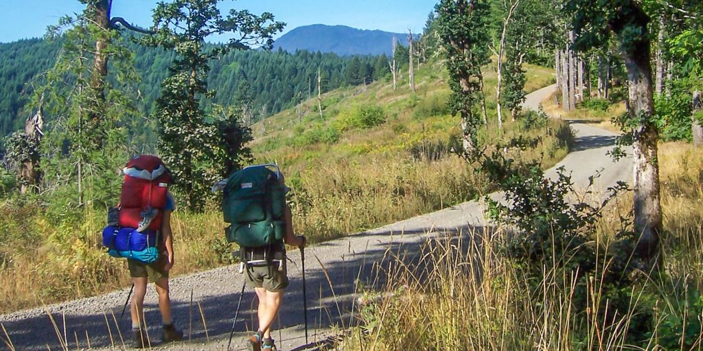
 On Saturday, August 21, the Corvallis to the Sea (C2C) trail finally opened to the public. The ambitious trail, which spans roughly 60 miles from Corvallis to Newport, resulted from over 1,600 trail days from the board of directors, and 18 years of hard work from volunteers and board members alike.
During the ribbon-cutting ceremony, there were a lot of people to thank. C2C President Gary Chapman began with a light-hearted thanks to the early pioneers who explored the Oregon Territory and forged the Oregon Trail, before moving onto the volunteers.
“From pandemics to the Afghanistan pullout, there’s a lot of bad in the world right now,” said Chapman. “It’s good to celebrate those who volunteered their time to clear brush and trail to make this possible.”

A special thanks went to Rollie Bowers, a volunteer who has given countless hours of his time to help build the trail. He was awarded a trophy and Clif bar in thanks for his service — though it’s unclear which was valued more. After all, hikers value carbs very highly.
But work on the trail will never be finished, noted Chapman. “The future of the trail is literally in your hands now,” he said to the crowd that had gathered to celebrate with him and his colleagues.
And the C2C trail, like any other wilderness trail, truly is in the hands of the public. Littering, illegal camping, and general mistreatment of the environment are everyday struggles for the Forestry Service, and this trail is no different.
Not only is maintenance of the trail a never-ending process, but it’s hard and occasionally expensive work. Paths must be maintained, brush cut back, and safety measures checked regularly. This is where volunteers must play their parts.
“We’re happy to have finally reached the ‘mature organization’ stage with the completion of the trail,” Chapman said. “But now we just need to keep it going with volunteers. Help if you can, or donate if you can’t, but we’re going to need help keeping this going.”
Eleven Quick Tips
For those curious about the guidelines and difficulty of the trail, here are some basic tips:
- All sections of the trail are classed as easy to moderate hikes. Nonetheless, plan ahead and be sure to secure a map of the area to prevent hiking into regions in which you’re uncomfortable.The 4-mile stretch of the gated Old Peak Road requires a free annual permit from Starker Forests to hike. Call (541) 929-2477 to get the permit.
- Water is scarce. You will need to pack enough potable drinking water to make the hike. Herbicide is used regularly in the forest industry, so be careful eating foraged foods.
- High winds, especially in the western coastal regions, increase the risk of tree and limb fall. Be aware of your surroundings, and don’t push yourself to go further if you feel unsafe.
- C2C is a no-campfire trail, with the exception of Big Elk Campground. Water is scarce in many parts of the path, making drowning a fire difficult. In addition, the trail crosses through several stretches of private property — meaning the agreements in place forbid any fires or camping outside of clearly designated Forestry Service lands. Add to this, at the time of this article’s publication, all fires are forbidden due to the fire ban. The above link will update with current advisories and trail statuses in the future.
- Litter is a real problem on trails. Because of this, the C2C trail is a no-trace camping area. This means that everything you bring in must be packed out — plan to do so to avoid fines. Remember that an endangered species calls this trail home. To protect the Marbled Murrelet, the no-trace order is vital.
- Bring a trowel with you. You see, no-trace camping includes human waste. When within 200 feet of camping areas, trails, or water, you must bury your waste and use biodegradable materials to wipe. Alternatively, you’ll have to carry your waste out with you.
- Parts of the trail consist of bear and cougar country, meaning it is entirely possible you may encounter these fuzzy friends along your hikes. Bring bear-proof bags or vaults to secure all food, bury waste far away from your camp, and bring bear spray.
- Ticks, biting flies, and mosquitos are common on the trail. Bring spray repellant and check yourself and any pets for ticks regularly.
- Cyclists are welcome on the trail, though there are sections in which they must share the trail with hikers. If you plan to bike the trail, be aware of areas that are intended to be shared and proceed with caution.
- Some sections of the trail are deemed unsuitable for cyclists. On areas west of Harlan, look for white Carsonite posts with C2C symbols. The Eastern half is a shared trail, while the western half has sections intended as a bike route.
- The Forestry Service deemed many sections of the trail to be unfit for equestrian riders. The only legal areas in which you may ride your horse are on roads of the route, which is advised against, as well as the Sugar Bowl trail section between Shot Pouch Road and Mary’s Peak Road.
If you want further information on the difficulty of particular sections, directions, or other guidance, check the C2C website here. While current maps of the trail are not available digitally, there are up-to-date maps at the trailheads, as well as an older map of the eastern section right here.
The C2C organization is open to donations of time or money – if you want to help, reach out or visit their Donations & Volunteers page.
Now go enjoy the trail responsibly and safely. It was the product of countless work hours, so treat it as such.
By Ethan Hauck
Do you have a story for The Advocate? Email editor@corvallisadvocate.com